
Finding History in the Dunes: The Story Behind Marquette Park
Author: Rebecca Sherman
GARY, IN - If you have ever wandered through Marquette Park in Gary, Indiana—past the sweeping sand dunes, under the shadow of the historic Marquette Pavilion and the majestic Gary Aquatorium, and along the quiet, winding lagoons—you are treading on ground saturated with centuries of history. Spanning over 100 acres where the historic mouth of the Grand Calumet River once emptied into Lake Michigan, this world-class city park bears the name of one of the North American continent's most fascinating early observers: Father Jacques Marquette.
To understand why this scenic sanctuary exists here is to look at two different eras: the rugged 17th-century landscape Marquette witnessed, and the deliberate choice made in 1932 by a booming industrial city trying to anchor itself to America's deep era of early European exploration.
Imagining the Landscape: Past Meets Present at Marquette Park
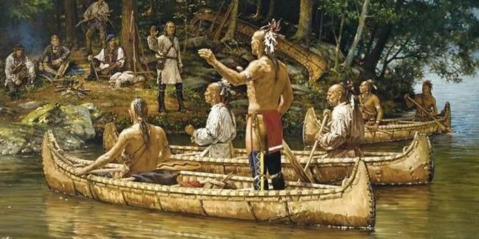
The Miami people built canioes and used them to traveled the waterways. They guided Pere Marquette’s journeys and explorations of the Great Lake Region. Photo Credit: Chautauqua-Wawasee.
To picture Marquette and Jolliet's journey is to imagine a North America completely unrecognizable today—a vast, uninterrupted expanse of wild land and open water. Traveling light in just two birchbark canoes, a crew of seven men slipped through an intricate network of untamed rivers and sprawling wetlands. Before industrial canals, dredging, and concrete shorelines reshaped the region, the Midwest was connected by a shifting web of shallow waterways and marshy prairies. When waterways grew too shallow or broke apart into competing drainage basins, the men would lift their fragile birchbark canoes onto their shoulders, carrying them across ancient overland portage trails carved out over centuries by Indigenous travelers.
Today, when you visit Marquette Park, that ancient landscape hasn't entirely vanished; it survives right alongside the modern pavilions, manicured lawns, and asphalt paths. If you want to experience it firsthand, you don't just have to look—you can immerse yourself in it. You can hike the park's scenic trails—offering roughly 3 to 4 miles of winding paths weaving through the dunes, lagoons, and oak savannas—or bring your own kayak or canoe to launch right on the historic lagoon via the park's accessible ADA water launch (or join occasional free paddling events hosted by the National Park Service). Gliding across the water or walking the sandy trails lets you experience a striking echo of what Father Marquette saw, heard, and felt over three centuries ago. Close your eyes for a moment, and you can almost imagine the rhythmic lap of lake water against the shore, the gentle calls of shorebirds drifting overhead, and the wind whispering through the tall marram grass on the foredunes. It is an invitation to step past the modern park amenities, look out at the wild sweep of Lake Michigan, and see the landscape through the eyes of an early traveler discovering a truly untamed world.
The 17th Century Connection
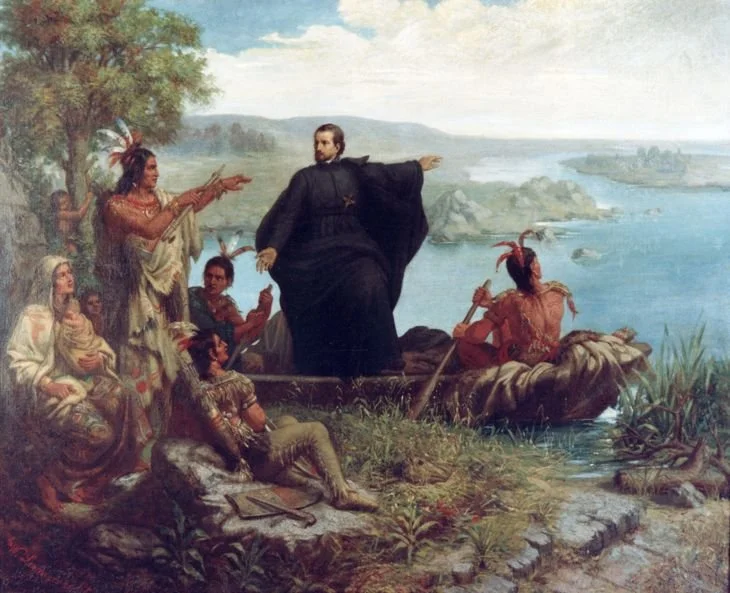
Father Jacques Marquette was a French missionary—a religious man whose curiosity, patience, and linguistic gifts helped him map the interior of what would later become the Midwestern states of Wisconsin, Illinois, Indiana, and Michigan. Commissioned by the French colonial government, his job alongside his key companion, explorer and mapmaker Louis Jolliet, was to help chart the vast watershed connecting the Great Lakes to the Mississippi basin. As they traveled and mapped these waterways, they moved through the ancestral homelands and active trade routes of the Potawatomi, Miami, and Illinois confederacies. When reading Marquette’s journal, I was struck by the respect and admiration with which he described the calumet and the diplomatic traditions surrounding it. His footprint on the Calumet region is defined by two major chapters: first, a historic 1673 expedition commissioned to discover where the great Mississippi River emptied, which saw him and Jolliet paddle down the river and make a grueling return trip northward utilizing the vital Illinois and Chicago River portages; and second, a return journey in the winter of 1674–1675 to fulfill a promise he had previously made to local Indigenous groups to return to the area. Caught by the harsh winter and suffering from a severe, weakening illness, a gravely ill Marquette was forced to travel northward along the southern shores of Lake Michigan in the spring of 1675—passing through the region that includes what is today Miller Beach and Marquette Park in the heart of the Calumet region before passing away shortly after on May 18, 1675, along the western coast of Michigan.
What Marquette Wrote: The Sacred Power of the Calumet
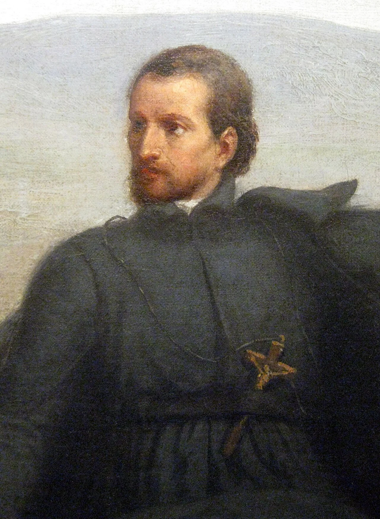
Closeup of Father Marquette, Painting By Wilhelm Lamprecht - The original hangs in the Haggerty Museum of Art at Marquette University, Milwaukee, Wisconsin. Public Domain, https://commons.wikimedia.org/w/index.php?curid=8041851
When we see the word "Calumet" all over Northwest Indiana today—from our rivers and businesses to local landmarks—it ties directly back to a tradition that Father Marquette observed and recorded in his journals: the original calumet, widely known to Europeans as the "peace pipe."
What Was the Calumet?
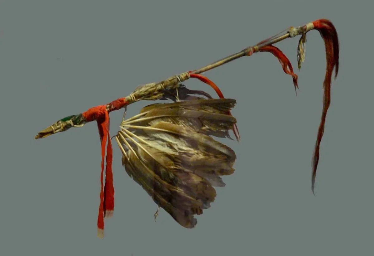
An example of a Calumet pipe, used by the Miami, the First People in the northwest Indiana region. Source: State of Illinois History Museum
Far more than a simple smoking pipe, the calumet was a deeply sacred, highly ritualized ceremonial object foundational to North American Indigenous cultures. Crafted from carved stone and adorned with delicate feathers and animal pelts, it acted as a universal passport, a diplomatic treaty, and a sacred bond. In many Indigenous diplomatic traditions, offering or accepting a calumet established immediate rules of hospitality, safe passage, and mutual trust between otherwise unfamiliar nations.
What Marquette Wrote in His Journal
When reading Marquette’s journals, one is struck by his profound reverence for Indigenous customs. Rather than viewing them through a judgmental lens, he documented the calumet with deep admiration, recognizing it as a masterpiece of diplomacy. He wrote in his journal:
"It is the token of peace and alliance, and a passport which enables you to travel safely amongst all the nations... You have only to show it, and you may walk unarmed in the midst of enemies, who solemnly assure you of all protection."
Time and again, when Marquette’s small party encountered tense or unfamiliar groups, raising the calumet transformed potential hostility into feasts of welcome and peaceful coexistence. Today, that enduring spirit of hospitality lives on; whether you are a local enjoying your own backyard, a first-time visitor discovering the area, or a traveler returning year after year to vacation along the shore, stepping onto the sands of Miller Beach and Marquette Park means stepping into a landscape whose very name is rooted in a tradition of welcoming guests.
Marquette’s Maps and Journals: Preserved and Rediscovered
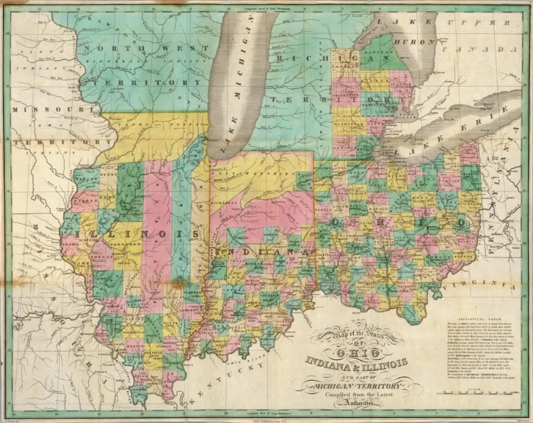
Prior to 1827, northern Indiana was inhabited by the Potawatomi and largely undeveloped by European immigrants. Found at: MapGeeks https://mapgeeks.org/indiana/#Coltons_1856_Map_of_Indiana
Marquette and Jolliet undertook an expedition to explore, map, and record the natural and human landscape of the unknown interior, with the goal of charting the vast interior terrain.
The maps and journals they produced were carefully preserved in Canada, where they ended up sitting untouched and unread for nearly 200 years until they were finally rediscovered and published in the mid-19th century. Today, you can view digital archives of these historic documents online, such as the early expedition mapping available through the Library of Congress Digital Collections. Additional primary historical repositories include:
The Archives of the Jesuits in Canada (Le Séminaire de Québec)
Library and Archives Canada in Ottawa, where these fragile manuscripts are curated for historians, researchers, and the curious public.
Naming the Park in 1932: Bridging Industry and Exploration
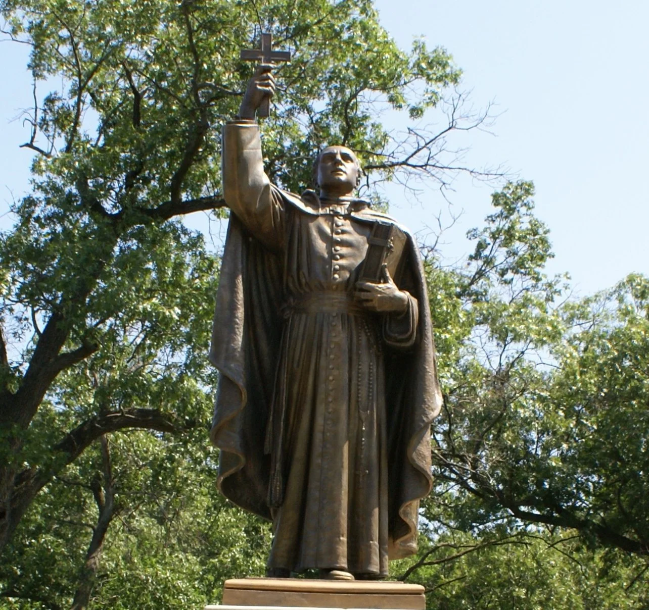
The park we walk today didn't always carry Marquette's name. Originally designated as Lake Front Park after US Steel gave the land to the city, Gary underwent a deliberate shift in the early 1930s. In June 1932, the city dedicated a grand monument sculpted by Henry Hering, officially anchoring the space to Father Marquette.
For a booming, smoke-stack-heavy steel town built entirely on modern industry, naming and monumentalizing the park was a powerful civic gesture. It was a way for Gary, as a young city. to reach back across the centuries, connecting the industrial present to the romantic, rugged history of the continent—weaving the heritage of French explorers and ancient waterways directly into the identity of Northwest Indiana.
The French Footprint All Around Us
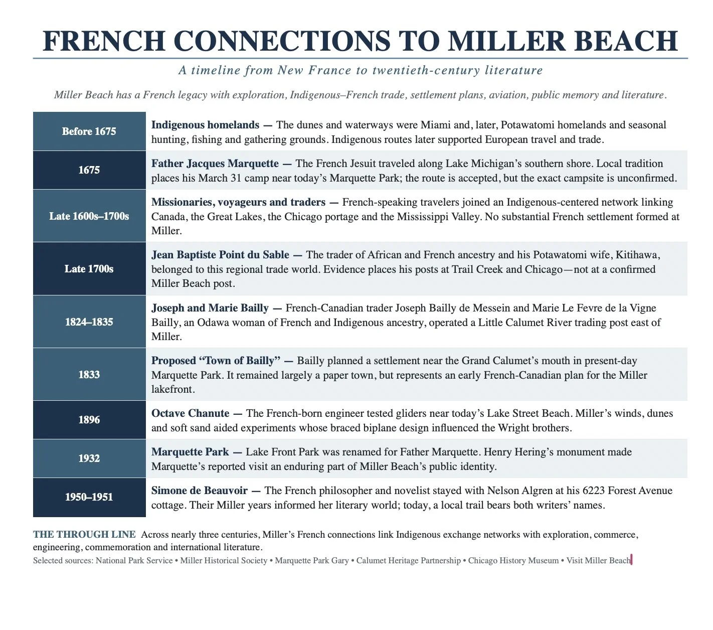
The legacy of these early French explorers isn't just locked away in history books or museum archives; it is written directly into the geography of the Midwest and our own backyard. Long after their canoes left the rivers, names like La Porte ("the gateway"), neighboring Portage, and cities like Joliet across the state line—along with historic railroad lines and regional landmarks—serve as everyday reminders of the French footprint on the landscape. Combined with the enduring presence of parks like Marquette, these names keep a centuries-old story alive right where we live, work, and welcome guests today.
The French connection continued with other famous people in Miller Beach history too, Octave Chanute (the Grandfather of Flight) and Simone de Bouvier (Philosopher and novelist). Stay tuned as we cover those stories in future blog posts
Rebecca Gail Sherman is an educator, local historian, and passionate advocate for the heritage and natural landscapes of Northwest Indiana. A Purdue University alumna, Becky spent 12 years teaching fourth-grade Indiana History in Crown Point Community Schools, where she also served as the district's fourth-grade social studies curriculum writer. Her research drew on primary sources, regional archives, and local history to connect Indiana's places and stories to the broader story of the state and nation.
Becky also spent 13 years working in environmental education and conservation, including with the National Park Service at the Paul H. Douglas Center at Indiana Dunes and the Lake County Soil and Water Conservation District, and served in board leadership with the Dunes Learning Center. Today, she combines her background in education, environmental science, and local history to share the stories of the Calumet Region and its landscapes. She lives in Miller Beach, Gary, with her husband, Brent.
The Visit Miller Beach Blog is made possible by a Legacy Foundation, Press Forward Grant.